> New Quay Street/Irwell Street Bridge Void 📍
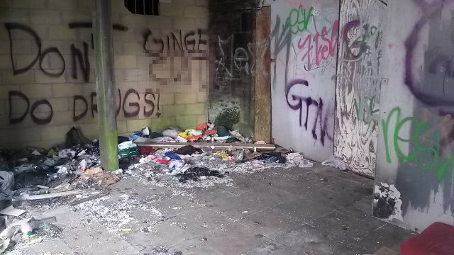
In April 2016 a correspondent took a photo of a wall at this point which has been put in place to block something off, but with a small opening left for ventilation purposes (shown in the top left of the photo, near the graffiti which has been pixelated for decency). They later examined an old photo from 1892 of the bridge, which show that there were voids left under the road at this point. A 1973 photo from the other side does not show any similar openings, so it appears these were either bricked up or the voids were enclosed (as suggested by their darkness in the older photo). Whether the voids still exist or have been filled in is not clear, but it is interesting to think that they might be there just beneath the road surface. The walkway this photo was taken from is now fenced off, so it is not possible to investigate further.

 Hidden Manchester Map