 Hidden Manchester Map
> Shooters Brook 📍
Shooters Brook rises in Newton Heath. It is a tributary of the Medlock and is fed by Newton Brook. Although these days it is diverted into the Dukes Tunnel and sewers it used to run openly through Manchester from the North East, meeting the Medlock at Garrat Hall.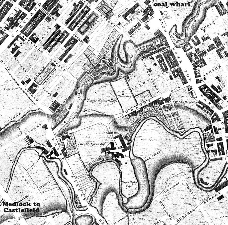
The lower (beyond Piccadilly Station) part of the route was plotted with a map from this thread on the Canalworld Discussion Forum, some from the six inch 1845 Ordnance Survey map and the rest from The Lost Rivers of Manchester, the map from which is reproduced online in A deeper understanding of climate induced risk to urban infrastructure: case studies of past events in Greater Manchester.