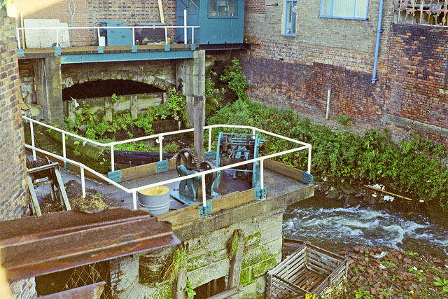
> Medlock Diversion Tunnel 📍
Here the Medlock is diverted via a siphon underneath the Bridgewater canal. Before this tunnel was built the river supplied the Bridgewater, but this was no longer necessary when the connection to the Rochdale Canals was made. The pins on the map represent ventilation grids. The tunnel and associated overflow are grade II listed structures.

You can see the route of this tunnel in Adshead’s illustrated map of St John’s Ward from 1851. Slightly further downstream the Bridgewater canal overflows through a weir named Giant’s Basin at Potato Wharf into the Medlock. There is a great bit of history for this stretch of the Medlock on Grace’s Guide to British Industrial History. I’m not sure exactly when the tunnel was completed, but if this passage by James Brindley refers to this work then that would place it around 1764. The canal itself reached Castlefield Wharf from Worsley by 1965 according to the Bridgewater Canal history page.
In order to feed that end of the navigation which is near Manchester he has raised and as it were swallowed up the river Medlock where he last year erected some stoneworks
There is a great 1936 picture of the Knott Mill weir (complete with some chaps looking proud of themselves) from the Manchester Archives. There are some pictures in ‘The Good, The Standard and The Ugly: Knott Mill Bridge’, an article about the Knott Mill Bridge on Manchester Confidential Article. There is a great photo of the sluice (and the whole length of the inner city Medlock) on Pete Blacker’s Flickr album, and more good ones of the same area on Ojay’s Northwest Exploration post. If you want to see inside the tunnel take a look at substormflow.
In April 2016 the culvert was surveyed by Geoterra, who used a combination of laser scanning and sonar to map the section of the culvert which crosses Chester Road to support a Peel Holdings development in the area. Their page about the project has some fascinating renderings of the 3D model they produced, showing the general shape of the tunnel.
 Hidden Manchester Map